
November 11-13 2020
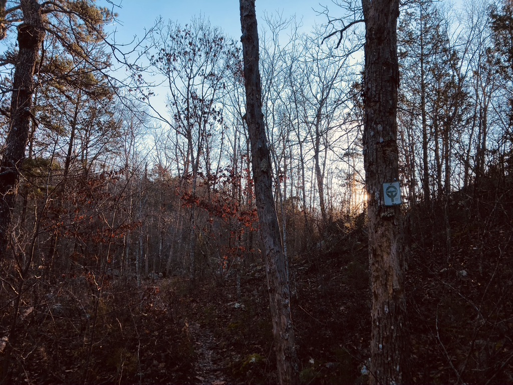
I arrived at the Taum Sauk State Park just before 9am. This is the high point in Missouri and lots of folks visit this park. Much to my delight, the parking lot was empty save for one car and I got my things together and headed down the trail. About a mile in, Mina Sauk falls is a popular place for day hikers, and there were two people at the top of the falls taking photos. I decided to keep hiking rather than wait for them to keep hiking. They were the only people I saw all day.
After I hiked past a well known rock formation known as the Devil’s Tollgate (I call it the Devil’s Toolbooth) I started to get a feeling that I have felt the two other times I have been out on trail since Covid. A since of guilt, combined with a kind of melancholy that has previously left me feeling unsure about myself and why I’m out on the trail. I kept thinking that the best thing would be to hike back the next day and not spend two nights out. I decided to take a break after a couple of hours of hiking and think about what was going on. I came to the conclusion that it was ok for me to be out on the trail, and that this was something that I loved to do, and that it was important for me to take time to get away from the house and my family and the internet and everything. That it’s ok for me to take time for myself. In the past this has never been an issue; I’ve always been good at self-care and boundaries and giving myself space and time for what I need. This year changed all of that. Hiking provides me with the time to reconfigure my approaches to self-care and boundaries. Once that dawned on me, I felt better literally right away and hiked on.

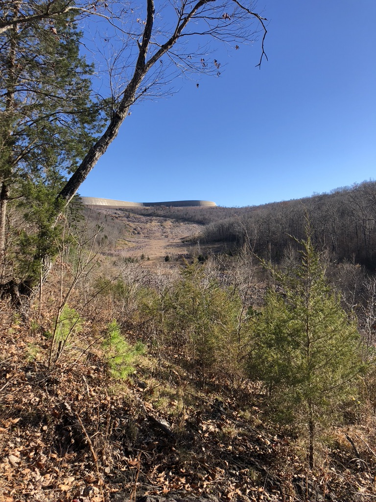
Around noon I came to a glade (open space) near the top of a ridge known as Ketcherside Mountain. I had views for days and saw two excellent places to camp. Since I mapped out my hike as a lollypop loop hike, I figured this would be a good spot to camp the next night on my way back to the car.
I noticed, in the distance, the Upper Taum Sauk reservoir which breached in 2005, flooding the area where I was planning on camping. If you look on Google, you can find some pretty interesting information about this event. Stuff like this is fascinating to me. After several hours of traversing ridges I came to what is known as The Scour. This is where the water raged through a small valley, destroying everything in its path. I picked up a liter of water here and hiked the last two miles down to the Black River.

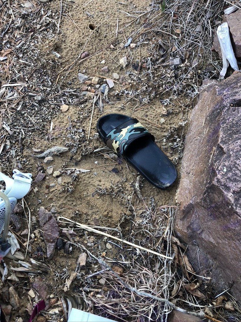
So in Missouri there’s a term called “shut-ins,” which are pools in a river created by rocks. Often times shut-ins feature small openings between large boulders where the river is forced through. Sometimes they make great swimming holes and sometimes they can be unsafe. Johnson’s Shut-Ins on the Black River are a bit north of where the Ozark Trail crosses the river, and I did not see them, but I know I’ll be back to this beautiful place in the future. I got to the river around 3pm and decided to cross it and look for a place to camp on the other side. I knew that I would not want to cross it in the morning in the cold. I took off my shoes, gaiters, socks and pants and to my good fortune I found an abandoned rubber slip on shoe that someone had let behind. And it was even my size. So with the help of my newly acquired functional garbage, I crossed the river. It felt wonderful.
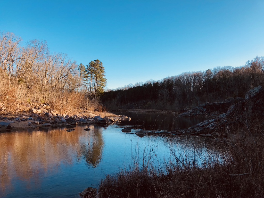


After looking around for about five minutes, I found an established campsite and pitched my tent as the sun was slowly disappearing. It wasn’t a perfect campsite, but it was better than having to cross the river in the morning.
Anyone who has slept in a tent on a slope knows the unique restlessness that comes with such a night. I kept slipping down, and which the slope was not super pronounced, it was enough to keep me awake and half-asleep most of the night. No matter; when I woke up in the morning I was happy to be where I was. I got some good photos of the river and then packed up and was hiking by 6:15am. I planned to hike 6 more miles on the Ozark Trail and then take a side trail down Goggins Mountain trail to the Johnson’s Shut-Ins campground, and then take another trail back over to the Ozark Trail near The Scour. There, I’d get water again and start hiking back, completing the lollypop loop. A good plan that panned out exactly as I had envisioned. It’s rare when that happens and I was pleased. But I get ahead of myself.
By 8:30 I was at the junction to the Goggins Mountain trail and took some time to check out the views from the various glades in this area. Soon I was hiking down the ridge on a really nice cruiser trail covered in yellow leaves. Delightful. I knew the trail went up another ridge and down to the parking lot near the highway but I didn’t feel like doing that, and since those miles are not Ozark Trail miles, I took a shortcut to the campground because I wanted to check it out for water, bathrooms and future car camping. I came across an ATV path and took it towards the campground rather than bushwack through the woods. A good decision, as the track took me right to the campground. Which was practically empty. I saw maybe five or six campers and that was it. I’ll be back for sure.
After learning that the water had been shut off and the bathrooms locked for the season, I started walking the two or so miles over to a spot where I could pick up the Ozark Trail again. My loop being almost complete, it was nice to have a couple of miles on flat, paved trail where I could space out and soak up the sunshine. Once I got back to the river I crossed it on the highway and bushwacked about 100 feet to the trail. Shortly after that I was back to The Scour. It was noon. I couldn’t believe I had made such good time, but I had a lot of energy and decided that since this would be my last water source of the day, I would pick up five liters and hike as far as I could. Which ended up being about 6 more miles, bringing my total to 18 miles for the day. I could have gone a few more miles but I knew there were no good places to camp and the Ketcherside Mountain glade was so perfect I could not pass it up.
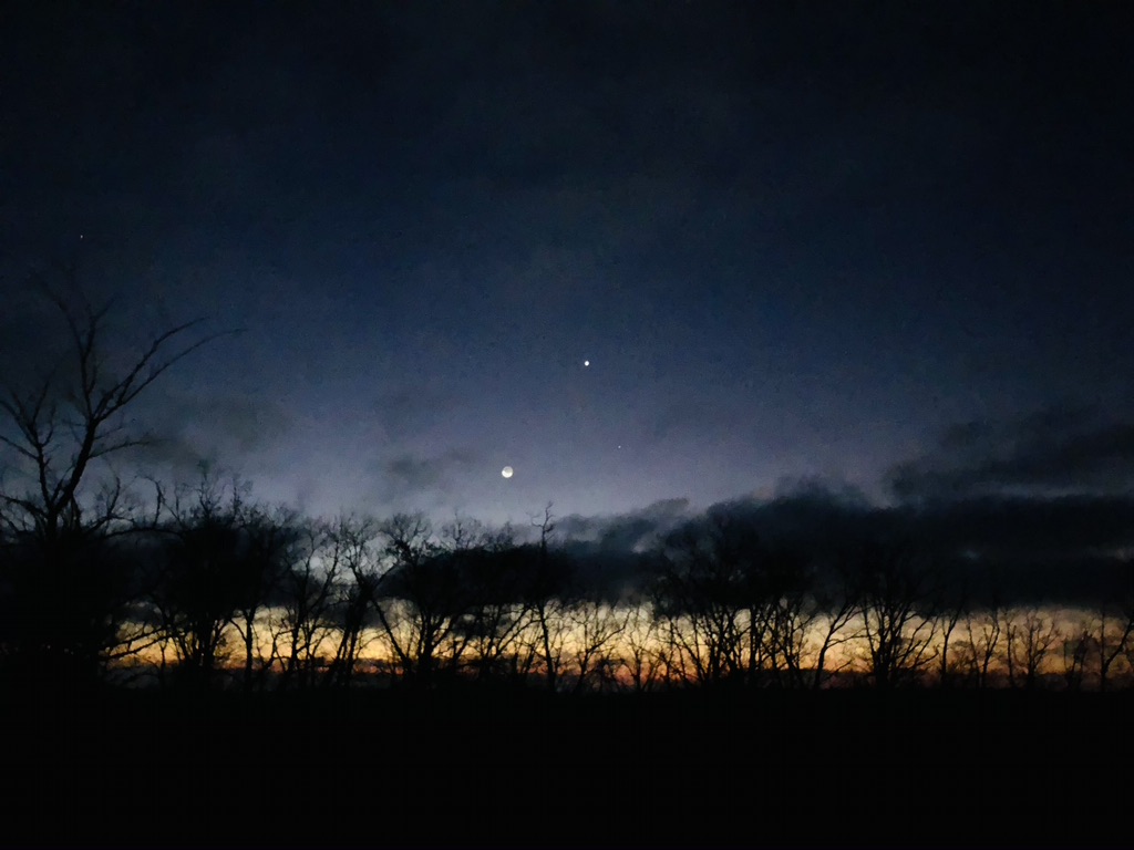
I pitched my tent as some clouds rolled in. Eating an early dinner meant I would have room later for chocolate. I read for awhile and watched the sky change colors, and the clouds roll through. Perfection.


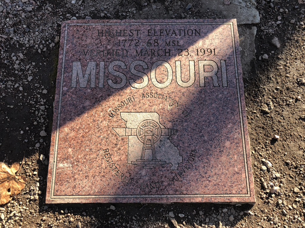
The next morning I was packed and ready to hike the last six or so miles to the car. It was an uneventful hike; I was pleased with the way everything went the day before and happy that I worked out the things going on in my mind and my heart about being out on the trail during Covid. I stopped in at the high point plaque and took an obligatory photo, and once I had put my gear in the car and turned on the heater, I ate my post-hike meal: bagel with salami, pepper jack cheese, mayo packet and mustard packet. Since I no longer stop at places along the way home to eat, this was my only option, and a good one at that.
